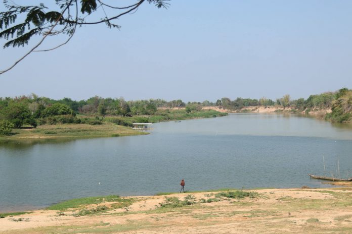
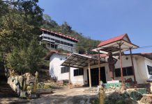
หาดท่าโฮง (หาดบ้านวังยาง) เป็นสถานที่ท่องเที่ยวทางธรรมชาติ โดยแม่น้ำชีและแม่น้ำมูลไหลมาบรรจบกันที่บ้านวังยาง ทำให้เกิดเป็นแม่น้ำสามสีตรงทางสามแยกที่แม่น้ำทั้งสองมาบรรจบกันการเดินทางถนนทางหลวงหมายเลข 226 ถึงแยกทางเข้าวัดป่านานาชาติ ตรงไปประมาณ 7 กิโลเมตร
ลักษณะเด่น สถานที่ท่องเที่ยวทางธรรมชาติ โดยแม่น้ำชีและแม่น้ำมูลไหลมาบรรจบกันที่บ้านวังยาง
ประวัติสถานที่ท่องเที่ยว หาดท่าโฮง (หาดบ้านวังยาง) ตั้งอยู่ ที่บ้านท่าขอนไม้ยูง หมู่ที่ 12 ตำบลบุ่งหวาย อำเภอวารินชำราบ จังหวัดอุบลราชธานี เป็นสถานที่ท่องเที่ยวทางธรรมชาติ โดยแม่น้ำชีและแม่น้ำมูลไหลมาบรรจบกันที่บ้านวังยาง ทำให้เกิดเป็นแม่น้ำสามสีตรงทางสามแยกที่แม่น้ำทั้งสองมาบรรจบกันการเดินทางถนนทางหลวงหมายเลข 226 ถึงแยกทางเข้าวัดป่านานาชาติ ตรงไปประมาณ 7 กิโลเมตร
Tha Hong Beach (Ban Wang Yang Beach) is a natural attraction. The Chi and Mun rivers converge at Ban Wang Yang. Resulting in a tricolor river at the junction where the two rivers converge. Travel on Highway No. 226 to the junction at the entrance to Wat Pah Nanachat, about 7 kilometers straight.
Features natural attractions The Chi and Mun rivers converge at Ban Wang Yang.
History of attractions Tha Hong Beach (Ban Wang Yang Beach) is located at Ban Tha Khon Mai Yung, Village No. 12, Bung Wai Sub-district, Warin Chamrap District. Ubon Ratchathani Province It is a natural tourist attraction. The Chi and Mun rivers converge at Ban Wang Yang. Resulting in a tricolor river at the junction where the two rivers converge. Travel on Highway No. 226 to the junction at the entrance to Wat Pah Nanachat, about 7 kilometers straight.

